
Features San Andrés 360
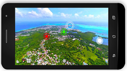
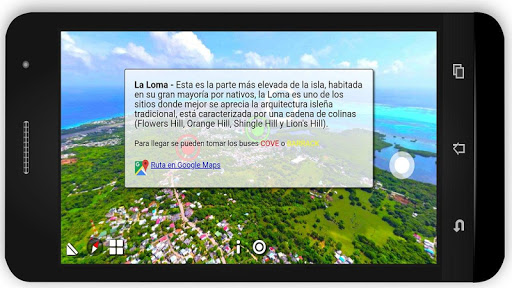
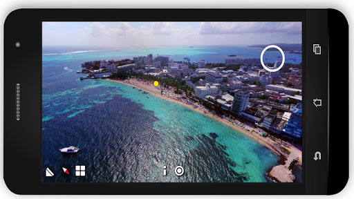
San Andres 360 is an application Guide / Map of San Andres Island, made using 360-degree panoramic aerial photos taken from strategic points to show the whole panorama of each traditional sector of the island, you can find information on each sector, emblematic points and bus routes to get to these.If you plan to go on vacation to San Andres Island Colombia, having this application installed prior to your arrival gives you the opportunity to know San Andrés in advance, know which are the most visited tourist attractions, how the sectors are connected and how to mobilize using transportation public, all this is possible using panoramic aerial views and landmarks, using these landmarks you can see and understand the relief of the island from north to south and move between sectors and points.You can navigate in the offline app to be located using only the reference points and recognizing the sector in which it is located or for a more accurate navigation you can use the GPS navigation of Google Maps, in the app you can find a link that will give you Google Maps coordinates to get to the sector that you see on screen, this is also possible to do Offline if you download the map of San Andres in the option of "Maps without Connection" Google Maps
Social Features
Connect and share with friends and the community.
Camera Features
Advanced camera features with editing capabilities.
Fitness Tracking
Track your workouts and monitor your health metrics.
See the San Andrés 360 in Action
Get the App Today
Available for Android 8.0 and above